Total Population and Density
Total Population and Density
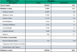
The population of Middlesex-London was 455,526 in 2016 (Figure 1.2.1).
Middlesex-London makes up 3.4% of the Ontario population, or one out of every 29 Ontarians.
Most of the population of Middlesex-London lived in the City of London (84.3%; 383,822) (Figure 1.2.1). According to the 2016 Census, London was the sixth largest city in Ontario and 15th largest in Canada.1
After the City of London, the municipalities with the largest populations were: Strathroy-Caradoc, Middlesex Centre and Thames Centre (Figure 1.2.1).
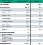
Population density was 137.3 people per square kilometer overall for Middlesex-London in 2016. This is much higher than Ontario’s average density at 14.8 people per square kilometer (Figure 1.2.2) However, it is lower than three of the four health units in Middlesex-London’s Peer Group (2015) (those health regions considered by Statistics Canada to be similar in terms of socio-demographics in 2015): City of Hamilton (480.5), Niagara (241.5), Windsor-Essex County (215.5). It is higher than the fourth peer health unit (Brant County, 119.5). 2
Density increased in 2016 by 3.7% from 132.4 people per square kilometer in 2011. In the previous decade, density has increased 8.7% from 126.3 people per square kilometer in 2006. 3
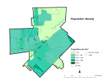
Population density varied widely by sub-region within Middlesex-London. The most densely population sub-regions of Middlesex-London were the City of London (913.1 people per square kilometre)) followed by Strathroy-Caradoc (77.1 people per square kilometre) (Figure 1.2.2).
The population of Middlesex-London is predominately urban, defined by living in a population centre (90.4%). Population centres are areas with a population of at least 1,000 and a density of 400 or more people per square kilometre. The boundaries of the urban population centres are not the same as the boundaries of the city or town despite having similar names. All areas outside population centres continue to be defined as rural areas. Nine out of ten residents of Middlesex-London live in urban population centres, including the large urban population centre of London (84.2%) or the small urban population centres of: Strathroy, Dorchester, Lucan, Glencoe, Ilderton, Mount Brydges, Parkhill (combined population of small urban centres 28,415; 6.2%) (Figure 1.2.3).
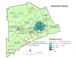
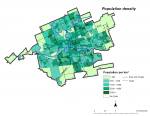
Maps (Figures 1.2.4, 1.2.5 and 1.2.6) show how population density varies widely across Middlesex-London with the highest density within the two largest urban population centres: the large urban population centre of London (overall 1,649.3 people per square kilometre) and the small urban population centre of Strathroy (overall 1,219.3 people per square kilometre).4 Within the population centre of London, higher density areas are distributed through-out the urban area and not concentrated in one part of the urban area.
Interpretive Notes
Population counts and population density help to define catchment areas for infrastructure that serves communities such as public health units. Higher population densities may permit more efficient delivery of public health services and infrastructure while urban intensification and the built environment are important considerations of public health in the creation of healthy natural and built environments.5
The 2016 Census of the Population, undertaken every five years across Canada, provides the most recent population counts with the exception of population estimates. Available at this time are postcensal estimates, based on the 2011 census, adjusted for under coverage and population growth.
The census provides one of the best statistical profiles of Middlesex-London. However, it should be interpreted with caution as it is known to underrepresent Indigenous populations. In 2016, the Chippewas of the Thames First Nation and the Oneida Nation of the Thames band councils did not give Statistics Canada permission to enter their territory and did not participate in the Census. In addition, less than 50 percent of the members of Munsee-Delaware Nation completed the more detailed questions such as age group. For these reasons, which are likely rooted in a distrust of government due to past and present colonial policies, there is an undercounting of Indigenous people and in particular an undercounting of those with Registered or Treaty Indian status. Our Health Counts London, a recent urban Indigenous study led by the Southwest Ontario Aboriginal Health Access Centre, indicated that only 14% of Indigenous adults that live, work or use services in London completed the 2011 Census.6
How this Indicator was Calculated:
Number of people per square kilometre. Calculated by dividing the total population by land area.
Ontario Public Health Standards: Requirements for Programs, Services, and Accountability
Population Health Assessment and Surveillance Protocol, 2018
References:
- Statistics Canada. Census in Brief: Municipalities in Canada with the largest and fastest-growing populations between 2011 and 2016 [Internet]. Ottawa, ON. Ministry of Industry; 2017 Feb 8. Available from: www12.statcan.gc.ca/census-recensement/2016/as-sa/98-200-x/2016001/98-200-x2016001-eng.cfm
- Statistics Canada. Table 17-10-0122-01 Census Profile. 2016 Census. Statistics Canada Catalogue no. 98-316-X2016001. Ottawa, ON. [updated 2018 May 30; cited 2018 Nov 27]. Available from: https://www12.statcan.gc.ca/census-recensement/2016/dp-pd/prof/index.cfm?Lang=E
- Statistics Canada. 2007. Middlesex-London Health Unit, Ontario (Code3544) (table). 2006 Community Profiles. 2006 Census. Statistics Canada Catalogue no. 92-591-XWE. [Internet] Ottawa (ON). [updated 2007 Mar 13; cited 2018 Nov 27]. Available from: www12.statcan.gc.ca/census-recensement/2006/dp-pd/prof/92-591/index.cfm?Lang=E
- Statistics Canada. 2017. London [Population centre], Ontario and Strathroy [Population centre], Ontario (table). Census Profile. 2016 Census [Internet]. Statistics Canada Catalogue no. 98-316-X2016001. Ottawa, ON. [updated 2017 Nov 29; cited 2018 Nov 26]. Available from: https://www12.statcan.gc.ca/census-recensement/2016...
- Williams M, Wright M, The impact of the built environment on the health of the population: A review of the review literature [Internet]. Barrie, ON: Simcoe Muskoka District Health Unit; 2007 [cited 2018 Nov 27]. 128 p. Available from http://www.simcoemuskokahealth.org/docs/default-source/hu-library/bhc_litreview
- Firestone M, Xavier C, O’Brien K, Maddox R, Muise GM, Dokis B, Smylie J. Our health counts London [Internet]. London (ON): Southwest Ontario Aboriginal Health Access Centre; 2018. Adult demographics; [cited 2018 Nov 27]; [3 p.]. Available from: http://soahac.on.ca/wp-content/uploads/2018/09/OHC-02A-Adult-Demographics-2.pdf
Last modified on: January 25, 2019
Jargon Explained
Peer Group (2015)
The grouping of Ontario public health units with socio-economic characteristics similar to those of Middlesex-London. It includes Brant County, City of Hamilton, Niagara, Windsor-Essex County and Middlesex-London. It is based on the 2015 Statistics Canada Peer Group A that includes health regions from across Canada that are characterized by having population centres with high population density and a rural mix
Population Centre
Population centre has replaced the term urban area formerly used by Statistics Canada. It is an area with a population of at least 1,000 and a density of 400 or more people per square kilometre. All areas outside population centres continue to be defined as rural areas.
Small population centres have a population of between 1,000 and 29,999; medium population centres, 30,000 and 99,999; and large urban population centres, 100,000 and over. The area of the population centre is not necessarily the same geographic area described by the city or municipal boundaries as it includes the more densely populated areas adjacent the population cores that meet the 2016 revised set of criteria and threshold levels.
Rural area
Rural areas (RAs) include all territory lying outside population centres. Taken together, population centres and rural areas cover all of Canada. Rural population also includes all population living in rural areas of cities such as the City of London, as well as population living in rural areas outside of cities
Population density
Number of people per square kilometre. Calculated by dividing the total population by land area.
